In the vast, interconnected system that makes up our planet, understanding and predicting the weather is both a critical scientific challenge and an essential part of everyday life. Whether planning a weekend picnic, managing agricultural resources, or preparing for natural disasters, weather prediction plays a significant role in decision-making. At the heart of modern meteorology lies a powerful tool: satellites.
This article delves into the role of satellites in monitoring weather patterns, forecasting weather changes, and their importance in safeguarding lives and optimizing resources. It also highlights the scientific advances that make satellites indispensable in weather prediction and how their contributions shape our understanding of the Earth’s climate systems.
The Evolution of Weather Prediction
1. Early Weather Forecasting
Before the advent of satellites, weather forecasting relied on ground-based observations, such as barometric pressure, wind speed, and temperature readings. These methods, while useful, were limited in scope and often led to inaccurate forecasts.
2. The Satellite Revolution
The launch of the first weather satellite, TIROS-1, in 1960 marked a turning point in meteorology. For the first time, scientists could observe Earth’s atmosphere from space, providing unprecedented insights into large-scale weather patterns.

What Are Weather Satellites?
Weather satellites are specialized spacecraft equipped with advanced instruments to monitor the Earth’s atmosphere, oceans, and land. They fall into two main categories:
1. Geostationary Satellites
- Positioned about 36,000 kilometers above Earth, these satellites remain fixed over a specific area.
- They provide continuous monitoring of weather changes in real-time, making them essential for tracking hurricanes and storms.
2. Polar-Orbiting Satellites
- These satellites orbit closer to Earth, covering the entire planet by sweeping from pole to pole.
- They capture detailed data on temperature, humidity, and other atmospheric variables.
How Satellites Collect Weather Data
Satellites use an array of sensors and technologies to gather information:
1. Visible and Infrared Imagery
- Visible imagery captures cloud cover and weather systems during daylight.
- Infrared sensors measure heat emitted by Earth’s surface and atmosphere, allowing for round-the-clock monitoring.
2. Microwave Radiometers
These instruments detect microwave radiation to measure precipitation, sea surface temperatures, and ice cover.
3. Atmospheric Sounders
Sounders analyze vertical profiles of the atmosphere, providing data on temperature, humidity, and pressure.
4. Radar and Lidar Systems
- Radar detects precipitation intensity and movement.
- Lidar measures wind speeds and aerosol concentrations in the atmosphere.
The Role of Satellites in Weather Prediction
Satellites have transformed how meteorologists understand and forecast weather patterns. Here’s how they contribute:
1. Monitoring Weather Systems
Satellites provide a bird’s-eye view of the Earth, enabling the tracking of large-scale phenomena like cyclones, jet streams, and weather fronts.
Example
During hurricane season, satellites help meteorologists monitor storm formation and predict their trajectory, intensity, and potential landfall.
2. Real-Time Data Collection
Geostationary satellites offer continuous monitoring, delivering real-time updates crucial for issuing timely weather alerts.
Impact
This capability is vital for regions prone to severe weather, allowing for faster evacuations and better disaster management.
3. Improving Forecast Models
The data collected by satellites feeds into complex computer models that simulate the atmosphere and predict future weather changes.
Benefits
- Increased forecast accuracy for short-term and long-term predictions.
- Enhanced understanding of climate trends.
4. Understanding Climate Systems
Satellites play a pivotal role in studying Earth’s climate by tracking long-term changes in temperature, precipitation, and atmospheric composition.
Key Contributions
- Monitoring polar ice melt and sea level rise.
- Measuring greenhouse gas concentrations and their effects on global warming.
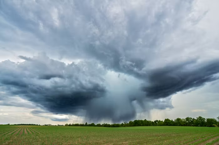
Satellites and Extreme Weather Events
Extreme weather events, such as hurricanes, tornadoes, and floods, pose significant threats to life and property. Satellites are indispensable in mitigating these risks:
1. Hurricane Tracking
Satellites monitor the development of tropical storms, providing critical information on their path and intensity.
Case Study: Hurricane Katrina
In 2005, satellite data helped predict Hurricane Katrina’s landfall, enabling authorities to prepare and evacuate residents, saving countless lives.
2. Flood Forecasting
By tracking rainfall and river systems, satellites assist in predicting flood-prone areas, allowing communities to take preventive measures.
3. Drought Monitoring
Satellites measure soil moisture and vegetation health, helping governments plan for water shortages and manage agricultural resources.
How Satellites Shape Our Understanding of Weather Patterns
1. Global Perspective
Satellites provide a comprehensive view of the Earth’s weather systems, revealing patterns that ground-based observations cannot capture.
Example
The El Niño phenomenon, which impacts global climate and weather, is better understood through satellite monitoring of ocean temperatures.
2. High-Resolution Imagery
Advances in satellite technology offer detailed visuals, helping scientists identify subtle changes in weather patterns and make accurate forecasts.
3. Integration with Other Technologies
Satellites work in tandem with ground-based sensors, weather balloons, and radar systems, creating a robust network for comprehensive weather analysis.
Future Innovations in Weather Satellites
As technology evolves, weather satellites continue to become more sophisticated:
1. Hyperspectral Imaging
New satellites will capture detailed spectral data, improving atmospheric analysis and weather model accuracy.
2. AI and Machine Learning
AI-driven algorithms will process satellite data faster and enhance predictive capabilities.
3. Miniature Satellites (CubeSats)
Smaller, cost-effective satellites are being developed to complement larger systems, providing more frequent updates.
Benefits of Satellite-Based Weather Prediction
1. Saving Lives
Accurate and timely weather forecasts allow communities to prepare for severe weather, reducing casualties and property damage.
2. Supporting Agriculture
Farmers rely on weather data to plan planting and harvesting schedules, optimizing crop yields and minimizing losses.
3. Enhancing Aviation and Shipping
Satellites provide vital information on turbulence, storm systems, and ocean conditions, ensuring safer travel and transport.
4. Mitigating Climate Change Impacts
By tracking long-term weather changes, satellites aid in crafting policies and strategies to combat climate change.
Challenges and Limitations
While satellites are powerful tools, they also face challenges:
1. High Costs
The development, launch, and maintenance of satellites require significant investment.
2. Data Overload
The vast amount of data generated can be overwhelming, necessitating advanced processing tools and skilled analysts.
3. Vulnerability to Space Hazards
Satellites are exposed to risks like space debris and solar radiation, which can affect their performance.
How You Benefit from Satellite Weather Prediction Every Day
Even if you’re not a meteorologist, satellites influence your daily life in several ways:
1. Weather Apps
The forecasts you check on your phone are powered by satellite data.
2. Travel Plans
Airlines use satellite data to adjust flight paths and avoid turbulence or storms.
3. Emergency Alerts
Warnings about severe weather conditions, such as tornadoes or heatwaves, rely on satellite observations.
Satellites have revolutionized weather prediction, providing accurate, real-time insights into weather patterns and weather changes. Their contributions extend beyond daily forecasts, shaping global efforts to understand and address climate challenges.
As technology advances, the role of satellites in meteorology will only grow, offering even greater precision and deeper insights. By recognizing their importance, we can continue to harness their potential for a safer, more resilient world.
Whether it’s a sunny day or a stormy night, we owe much of our understanding of the skies to the incredible work of satellites orbiting above.